Surveying specialists still grapple with the speed-accuracy trade-off. Not so much in terms of raw power like the Saturn V (or its modern Space Launch System upgrade) but of project completion speed, data capture, and precision measurement
“Fast is fine, but accuracy is everything” – Wyatt Earp, American Frontiersman
Leave it to a 19th-century American gunslinger renowned for his uncanny accuracy and shootout at the O.K. Corral to comment on an age-old conundrum: the speed vs. accuracy challenge.
Historically, Wyatt Earp’s words are correct: nine times out of 10, speed and accuracy were opposite ends of the spectrum. You can’t have one at the expense of the other. There is always a compromise.
In the latter 20th century, however, the speed-accuracy trade-off began to give way. Take, for instance, NASA’s Saturn V rocket. With a first stage capable of reaching speeds of over 6,000 mph, orbital insertion followed by translunar injection, was engine speed and precision navigation at its finest. Too slow and Apollo couldn’t escape the Earth’s gravitational pull. Too imprecise a burn and the spacecraft would miss the moon entirely, careening into deep space.
Today, surveying specialists still grapple with the speed-accuracy trade-off. Not so much in terms of raw power like the Saturn V (or its modern Space Launch System upgrade) but of project completion speed, data capture, and precision measurement. Thanks to advances in laser-based imaging technology, the construction industry, like the space sciences, is also witnessing a bridging of the gap that separates the speed-accuracy divide. It’s a narrowing driven by what FARO calls “Hybrid Reality Capture, powered by Flash Technology.”
What is Hybrid Reality Capture?
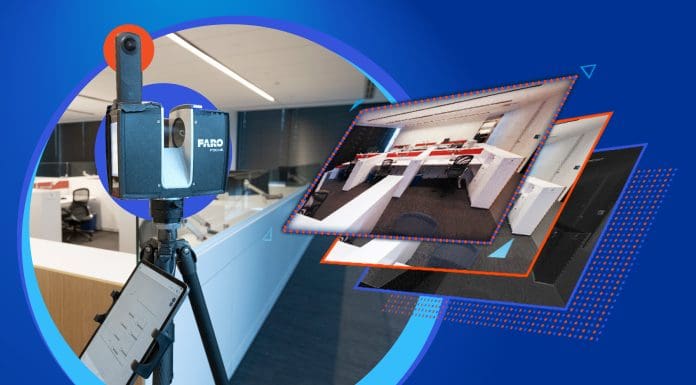
Hybrid Reality Capture for the FARO Focus Premium Laser Scanner is a Flash license that includes the ability to merge 360° panoramic images with a higher-speed scan to create full-colorised scans in less than 30 seconds with virtually no loss in data quality. It does so thanks to its ability to interpolate data points.
Whether it’s breathing new life into an aging power plant, the re-imagining of urban cores, or it’s reducing loss-of-life in the wake of a mass-casualty event, Flash Technology, will, to a large extent, solve the speed-accuracy trade-off (SAT). And it will allow construction and engineering and public safety professionals to do their jobs better, safer, faster and just as accurate when compared to traditional 3D terrestrial laser scanning methods.
Developed as a “best-of-both-worlds innovation,” Flash Technology will improve on-site productivity and deliver state-of-the-art colorized visual clarity at a highly affordable price. Industries that have long made trade-offs between capturing 3D data accurately or quickly will benefit greatly as this hybrid solution continues to saturate the market.
‘Time Enough at Last’
By cutting scanning time in half, with virtually no loss in data quality, Flash Technology is pioneering an imaging breakthrough in the 3D measurement and laser scanning space. This will enable accelerated workflows, faster project completion times, and the ability to take more scans with the time saved, leading to greater accuracy and an even better understanding of the built environment.
This is true for both Architecture, Engineering, Construction, and Operations & Maintenance (AECO) as well as for Public Safety Applications (PSA), and the surveying and mapping that’s standard in the geospatial industry.
With its data accessed through FARO Sphere XG, a SaaS cloud-based information platform, the Focus Premium Flash scans are ideal for companies and agencies taking large-volume 3D reality capture scans of buildings, infrastructure, corridors, mines and forests as part of their existing conditions, progress monitoring and pre-incident planning needs.
Flash for Orbis
Flash Technology is also built into the FARO Orbis Mobile Scanner. Even faster and more mobile than Focus, Orbis may sometimes be the right tool especially for jobs that require up to 2-millimeter accuracy with Flash scanning.
Flash in Orbis’ context denotes two elements:
The 15-second speed of stationary capture during a normal SLAM scan.
The ability for Flash to create clean and more accurate data as a result of the stationary scans.
And while Focus with Flash is fast, with 30-second static capture times the norm, Orbis is 50% faster than that, with a point cloud accuracy good enough for many projects. What it comes down to is a case-by-case contractor/subcontractor calculus of which tool is the right tool for the right job, balancing speed and simplicity of use with accuracy.
What makes Flash “Flash” for Orbis is the impressive accuracy of data capture – especially given that it’s slower with Flash but offers up to 3mm better than competitor products – all housed in a fully portable, handheld SLAM-based mobile mapping device.
The Future in ‘Focus’
To be sure, hybrid reality capture isn’t the end of the story. Nor is the Focus Premium or Orbis.
As processing power continues to increase and artificial intelligence exerts its growing influence, even faster and even more accurate solutions are bound to be released. The gap between accuracy and speed will only narrow. While we may be a few years (decades) away from fully eliminating the speed-accuracy trade-off, hybrid technologies like Flash, are taking us one step closer to that reality.
Said another way, in the 21st century accuracy is not everything. Because speed is quite literally, catching up. And FARO Technologies is helping lead the way.
*Please note that this is a commercial profile.
The post Hybrid Reality Capture: Bridging the gap between speed and accuracy appeared first on Planning, Building & Construction Today.


