

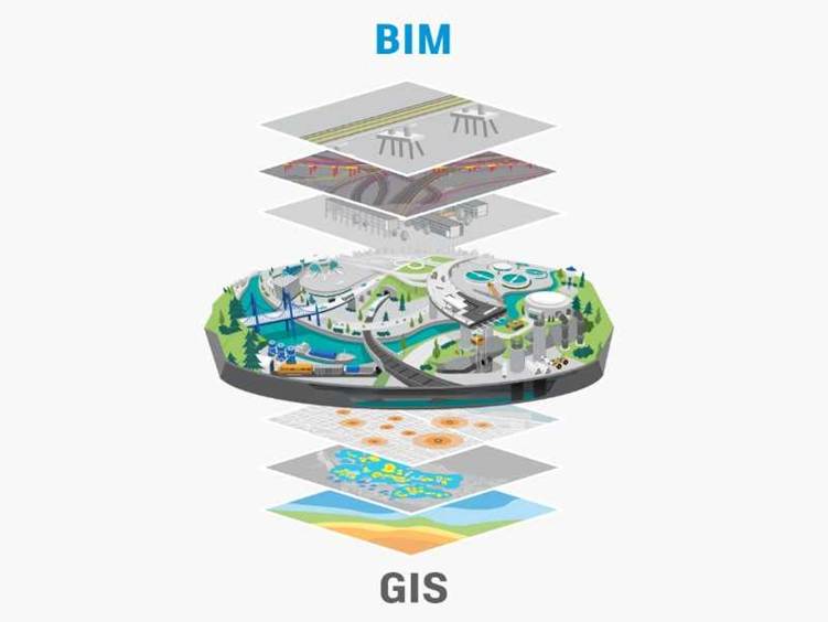

In today’s fast-evolving technological landscape, combining Building Information Modelling (BIM) and Geographic Information Systems (GIS) is changing how we analyze and use 3D data. By bringing these two powerful tools together, industries such as construction, urban planning, and infrastructure management can achieve more precise and meaningful outcomes. This article explains how BIM and GIS integration
In today’s fast-evolving technological landscape, combining Building Information Modelling (BIM) and Geographic Information Systems (GIS) is changing how we analyze and use 3D data. By bringing these two powerful tools together, industries such as construction, urban planning, and infrastructure management can achieve more precise and meaningful outcomes. This article explains how BIM and GIS integration
In today’s fast-evolving technological landscape, combining Building Information Modelling (BIM) and Geographic Information Systems (GIS) is changing how we analyze and use 3D data. By bringing these two powerful tools together, industries such as construction, urban planning, and infrastructure management can achieve more precise and meaningful outcomes. This article explains how BIM and GIS integration