

The post The Role of Satellite Data in Green Construction appeared first on UK Construction Blog.
As the process of urbanization doesn’t seem to slow down, it fuels the demand for the new city infrastructure. Yet, building such infrastructure inevitably raises concerns about its potential damage to the environment. Green building practices, emphasizing resource efficiency and ecological responsibility, have gained traction as a means to address this dilemma.
However, achieving truly sustainable construction extends beyond using environmentally friendly materials or optimizing energy consumption. It requires a comprehensive understanding of the surrounding environment, including land characteristics, climate patterns, and resource distribution — factors that conventional approaches often overlook. This is where satellite technology becomes a game-changer. With the ability to view the latest satellite imagery, developers can evaluate site conditions, identify environmental risks, and make data-driven decisions that foster durable, low-impact structures.
How Satellite Data Supports Sustainable Construction
From selecting environmentally friendly sites to monitoring ongoing environmental impacts, the latest satellite imagery provides valuable insights that help reduce the ecological footprint of new developments. Let’s break down how that works.
Selecting Construction Sites with Minimal Ecological Disruption
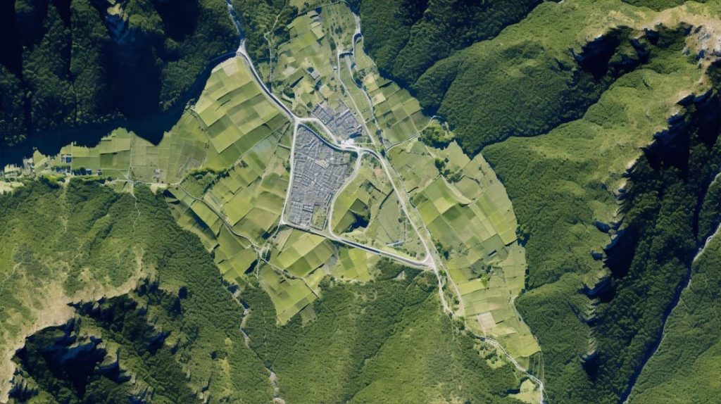
One of the most significant contributions of satellite technology to green construction is in site selection. Poorly chosen construction sites can lead to soil erosion, habitat destruction, and increased vulnerability to climate-related risks. By analyzing the latest satellite images of Earth, developers can assess landscapes before breaking ground, ensuring minimal ecological disruption.
High-resolution satellite imagery helps identify sensitive areas such as forests, wetlands, and wildlife habitats that require preservation. Historical satellite images offer valuable insights into land-use changes over time, allowing developers to avoid locations prone to flooding, subsidence, or erosion. Additionally, remote sensing technology enables a detailed analysis of soil stability and topography, ensuring that construction takes place on land suitable for long-term structural integrity.
By using satellite imagery for site selection, construction projects can avoid environmentally destructive practices, such as deforestation or wetland drainage, and instead focus on areas that can support sustainable development.

Monitoring Urban Expansion and Preventing Deforestation
Urban expansion often leads to environmental degradation when not properly managed. Cities frequently spread into green spaces, leading to deforestation, increased harmful emissions, and loss of biodiversity. Satellite imagery plays a crucial role in monitoring these trends and helping the concerned to advocate for more responsible urban planning.
With the latest satellite imagery maps, planners can track deforestation in real time, detect illegal land clearing linked to construction, and intervene before irreversible damage occurs. These maps also play a key role in sustainable city design by identifying areas for green spaces like parks, rooftop gardens, and nature reserves. Additionally, they highlight underutilized urban land that can be repurposed, reducing the pressure to clear forests for new developments. By using satellite-driven insights, cities can grow responsibly, preserving biodiversity, reducing heat buildup, and creating healthier, more livable environments.
Tracking Construction-Related Environmental Changes
Construction activities can significantly impact the environment, even after a project is completed. Satellite monitoring provides a powerful tool for tracking these effects and ensuring that developers adhere to sustainable practices.
Some key environmental factors monitored through satellite technology include:
- Deforestation and habitat destruction: By comparing past and present satellite images, experts can detect tree loss and measure the impact of construction projects on surrounding ecosystems.
- Water resource management: Construction sites often require large amounts of water for dust suppression, concrete mixing, and other processes. Satellite data helps track water usage, ensuring that local sources are not depleted or polluted.
- Air quality and pollution levels: Satellite sensors detect emissions from construction sites, measuring dust, particulate matter, and other pollutants that contribute to poor air quality. By monitoring these factors, developers can adjust their activities to minimize harm.
By integrating satellite monitoring into green construction strategies, developers can take corrective action before problems escalate, protecting both the environment and public health.

Ensuring Compliance with Environmental Regulations
Governments and environmental organizations are implementing stricter regulations to ensure construction projects meet sustainability standards. However, monitoring compliance at a large scale can be challenging. This is where satellite data becomes an invaluable asset.
With the aid of the latest satellite images, regulatory agencies and developers can ensure adherence to environmental laws through real-time, objective data that verifies compliance with deforestation laws, emissions limits, and land-use regulations. Authorities can monitor protected areas to prevent illegal construction in conservation zones and environmentally sensitive regions. Besides, construction firms can reduce legal risks by proactively leveraging satellite imagery to demonstrate compliance, helping them avoid fines, legal disputes, and costly project delays.
This transparency benefits both developers and environmental organizations, creating a more accountable construction industry.
Reducing Costs Through Resource Efficiency and Waste Reduction
One of the key advantages of integrating satellite technology into green construction is the potential for cost savings. Sustainability isn’t just about minimizing harm but about maximizing efficiency. Satellite data helps developers optimize their use of resources, ultimately reducing waste and unnecessary expenses.
Here’s how satellite technology contributes to cost-effective, green construction:
- By analyzing terrain and logistics, satellite data helps developers plan more efficient transportation routes, reducing fuel consumption and carbon emissions.
- Remote sensing technology can identify the most efficient ways to use land and materials, preventing unnecessary waste during construction.
- Early detection of potential hazards, such as landslides, floods, or subsidence, can prevent costly damage and project delays.
By incorporating satellite data into project planning and execution, construction firms can build more efficiently, reduce their environmental impact, and lower overall costs.
As urbanization accelerates and environmental challenges intensify, satellite data will play an increasingly critical role in green construction. By using these insights, developers can reduce costs, improve efficiency, and create infrastructure that harmonizes with nature rather than disrupting it. The future of sustainable construction depends on smart, science-based solutions, satellite technology being one of them.